

Home / Newport Beach / Living in Newport Beach
Living in Newport Beach
Newport Beach is a coastal city in Orange County, about 45 miles southeast of downtown Los Angeles, with neighborhoods around Newport Harbor and along the ocean from the Balboa Peninsula to Newport Coast. The Census Bureau estimates 81,977 people lived here in July 2025. Balboa Island and Lido Isle sit inside the harbor, and the Balboa Island Ferry crosses to the Peninsula.
Every fact links to where we read it. Sponsors can't change anything on this page.
Quick facts
- People in the city
- 81,977July 1, 2025 Census estimate (Vintage 2025), down from 85,234 in the April 2020 estimates baseSource
- Schools
- Newport-Mesa USDCovers nearly all of the city; a few tax rate areas near the airport carry Santa Ana Unified bonds, so check an address with the district locatorSource
- Downtown Los Angeles
- About 1 hrAbout 45 miles via I-405 and I-5 with no traffic; much longer at rush hour. Estimate
- Irvine Spectrum
- About 15 minAbout 10 miles from Fashion Island via SR-73, no traffic. Estimate
- John Wayne Airport
- About 10 minAbout 5 miles from Fashion Island; the airport sits just north of the city. Estimate
- Property tax
- About 1.05%1% base plus voter-approved bonds; 1.05129% in tax rate area 07-001 for 2026-27, varies by tax rate areaSource
Neighborhoods
Balboa Island Established
Small island in Newport Harbor with cottages, the Marine Avenue shops and the car ferry to the Balboa Peninsula.
Newport-Mesa USD
Balboa Peninsula Established
Long strip between the ocean and the harbor with the Newport and Balboa piers, the Fun Zone and Cannery Village, generally in the Newport Harbor High area.
Newport-Mesa USD
Big Canyon Established
Gated community around the Big Canyon Country Club golf course near Fashion Island.
Newport-Mesa USD
Corona del Mar Established
Seaside village on the east side of the harbor entrance with shops along East Coast Highway and Corona del Mar State Beach, generally in the Corona del Mar High area.
Newport-Mesa USD
Dover Shores Established
Neighborhood on the Upper Bay off Dover Drive, with many homes on the water.
Newport-Mesa USD
Eastbluff Established
Planned neighborhood above the Upper Newport Bay preserve, near the Corona del Mar Middle and High School campus.
Newport-Mesa USD
Harbor View Established
Hillside neighborhoods above Corona del Mar around Harbor View Elementary, generally in the Corona del Mar High area.
Newport-Mesa USD
Lido Isle Established
Residential island in the harbor next to Lido Marina Village, generally in the Newport Harbor High area.
Newport-Mesa USD
Newport Coast Established
Hillside communities above Crystal Cove State Park, annexed by the city in 2002, generally in the Corona del Mar High area.
Newport-Mesa USD
Newport Crest Established
Condominium community in West Newport near Superior Avenue and Sunset Ridge Park.
Newport-Mesa USD
Newport Heights Established
Older neighborhood on the bluffs above Mariners Mile near Newport Harbor High School.
Newport-Mesa USD
Westcliff Established
Neighborhood on the bluffs west of the Upper Bay with the Westcliff Plaza shops, generally in the Newport Harbor High area.
Newport-Mesa USD
School areas are general. Confirm any address with the Newport-Mesa USD School Locator.
Schools
Newport-Mesa Unified School District: Nearly all of Newport Beach, plus Costa Mesa NMUSD School Locator
Campuses in the city Source
High schoolsCorona del Mar Middle and High School
Newport Harbor High School
Newport Harbor High School
Middle and intermediate schoolsEnsign Intermediate School
Corona del Mar Middle School (on the high school campus)
Corona del Mar Middle School (on the high school campus)
Elementary schoolsAndersen Elementary
Eastbluff Elementary
Harbor View Elementary
Lincoln Elementary
Mariners Elementary
Newport Coast Elementary
Newport Elementary
Newport Heights Elementary
Eastbluff Elementary
Harbor View Elementary
Lincoln Elementary
Mariners Elementary
Newport Coast Elementary
Newport Elementary
Newport Heights Elementary
A normal week here

Halloween Party at Central Library
Newport Beach Central Library, Children's Room, Newport Beach
Free, and fine for kids.


The Pearls
Bayside Restaurant, Newport Beach
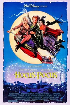
Hocus Pocus
The Lido Theater, Newport Beach
Everything this week in Newport Beach · Friday nights · The Brunch list · Kids
Property taxes
| Who taxes it | Rate | Source |
|---|---|---|
| 1% general levy (county, city, schools and districts) | 1.00000% | Source |
| Coast Community College District bonds (2002 and 2012 measures) | 0.02524% | Source |
| Newport-Mesa USD bonds (2005 measure) | 0.01755% | Source |
| Metropolitan Water District | 0.00850% | Source |
| Typical total, before exemptions | About 1.05% |
Tax rate area 07-001, fiscal year 2026-27, from the OC Auditor-Controller tax rate book (1.05129%). Areas in Santa Ana Unified pay more.
The basics
TrashCR&R Environmental Services collects under a city contract, and recycling goes out on your trash day. Santa Ana Heights is served through Costa Mesa Sanitary District. Find your collection day
WaterCity of Newport Beach Utilities for most homes. Some areas, including parts of Newport Coast, are served by Irvine Ranch Water District. City Utilities
PowerSouthern California Edison SCE
GasSoCalGas SoCalGas
VotingOrange County Registrar of Voters. Register online with the California Secretary of State. OC Registrar of Voters
LibraryNewport Beach Public Library: Central Library at 1000 Avocado Ave plus Balboa, Corona del Mar and Crean Mariners branches. Hours and locations
The short version
Quick answers
How many people live in Newport Beach, California?
81,977. July 1, 2025 Census estimate (Vintage 2025), down from 85,234 in the April 2020 estimates base.
What school district is Newport Beach in?
Newport-Mesa Unified School District: Nearly all of Newport Beach, plus Costa Mesa
How far is Newport Beach from Los Angeles?
About 1 hr to downtown Los Angeles, about 45 miles via I-405 and I-5 with no traffic; much longer at rush hour. Estimate.
What is the property tax rate in Newport Beach, California?
About About 1.05% per $100 of taxable value, typical total, before exemptions, adding up 1% general levy (county, city, schools and districts), Coast Community College District bonds (2002 and 2012 measures), Newport-Mesa USD bonds (2005 measure), Metropolitan Water District. Homestead and other exemptions lower the bill.
What neighborhoods are in Newport Beach?
Balboa Island, Balboa Peninsula, Big Canyon, Corona del Mar, Dover Shores, Eastbluff, Harbor View, Lido Isle, Newport Coast, Newport Crest.
When is trash pickup in Newport Beach?
CR&R Environmental Services collects under a city contract, and recycling goes out on your trash day. Santa Ana Heights is served through Costa Mesa Sanitary District.
Open spotQuestions go to the agent who presents this page
Thinking about Newport Beach? Ask a question.
When an agent presents this page, questions from here go straight to them, and nowhere else.
Claim Newport BeachAlso: